Home WebGIS Archaeological Information System
 Goals
Goals
In order to ensure data insertion homogeneity and to allow a centralized data management for such a complex framework as prescribed by the project guidelines (cartographic data and databases referring to the sites of 5 different zones inside the Alpine region), a WebGIS-based solution was selected as the best possible. In particular, Open Source applications were chosen, due to their optimal trade-off between high customizability and costs.
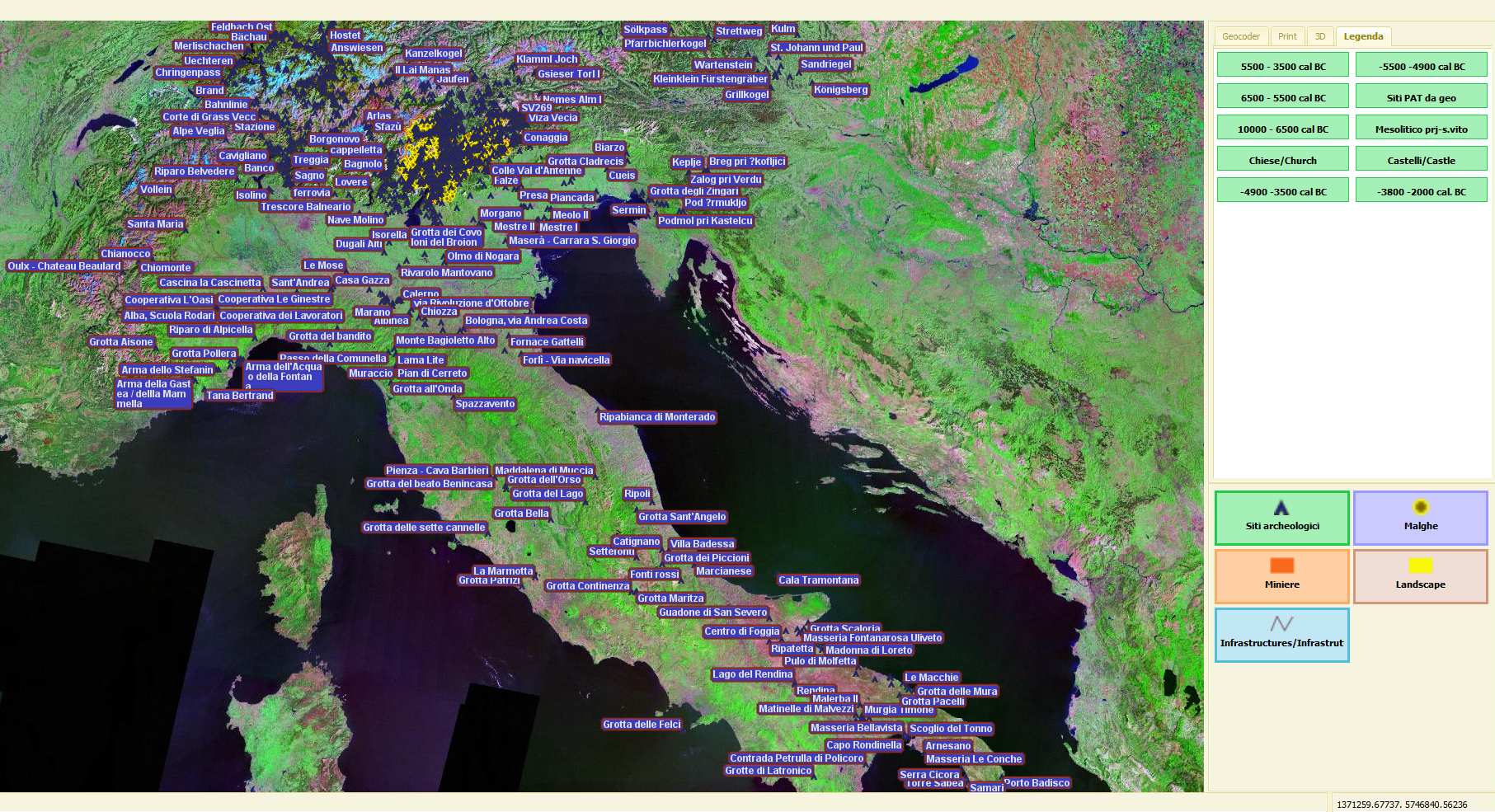
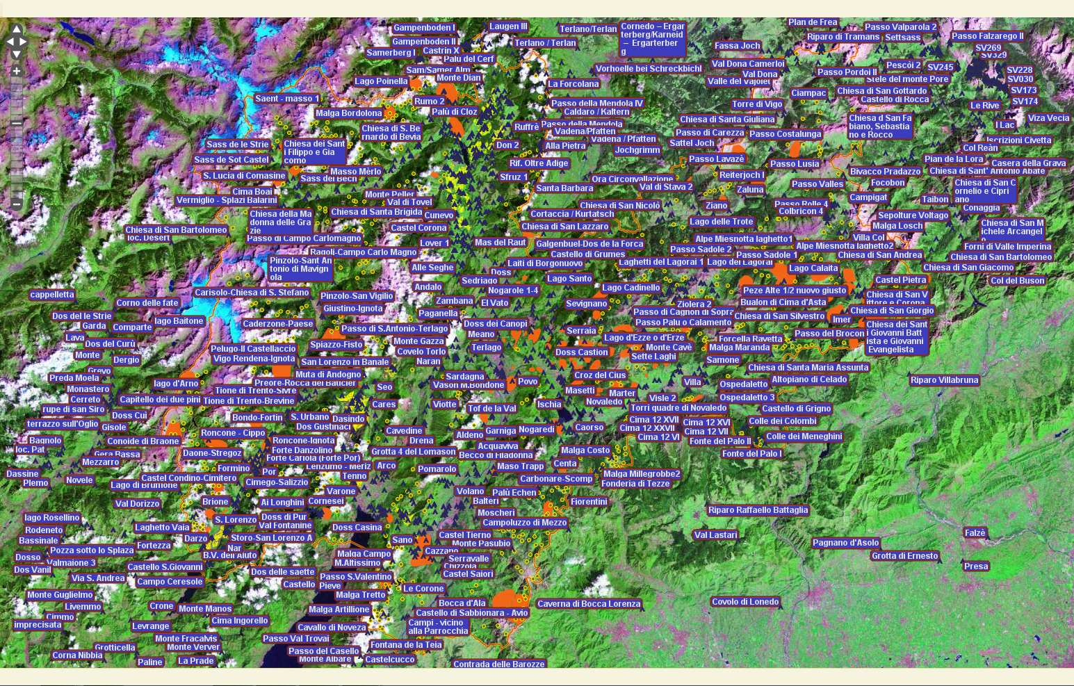
The realized WebGIS system allows the visualization, the georeferencing and the insertion of archaeological sites regarding the Pre- and Proto-History (together with their related bibliographic entries); moreover, it further gives the user the possibility of performing complex alphanumeric or geographic queries, of automatically creating reports describing the visualized site and of managing multimedia files linked to the site.
The WebGIS system was entirely realized by OpenSource technologies like Mapserver/MapBuilder as the WebGIS engine and development suite, and PostgreSQL/PostGIS as the RDBMS for the spatial data management. The whole project was realized following the Open Geospatial Consortium (OGC) standards to guarantee the full cross-platform interoperability and to simplify the collaboration among all different partner institutions.
AIS Guest (free and limited access)
progetto Apsat (TN)
progetto S. Vito (BL)